
Autonomous coastal observation

Persistent coastal observation.

OceanStride is developing DriftWing, a recoverable profiling system intended to extend environmental observation between vessel missions—for civilian monitoring and defence-supporting ocean intelligence.

Concept stage · current evidence is software-based

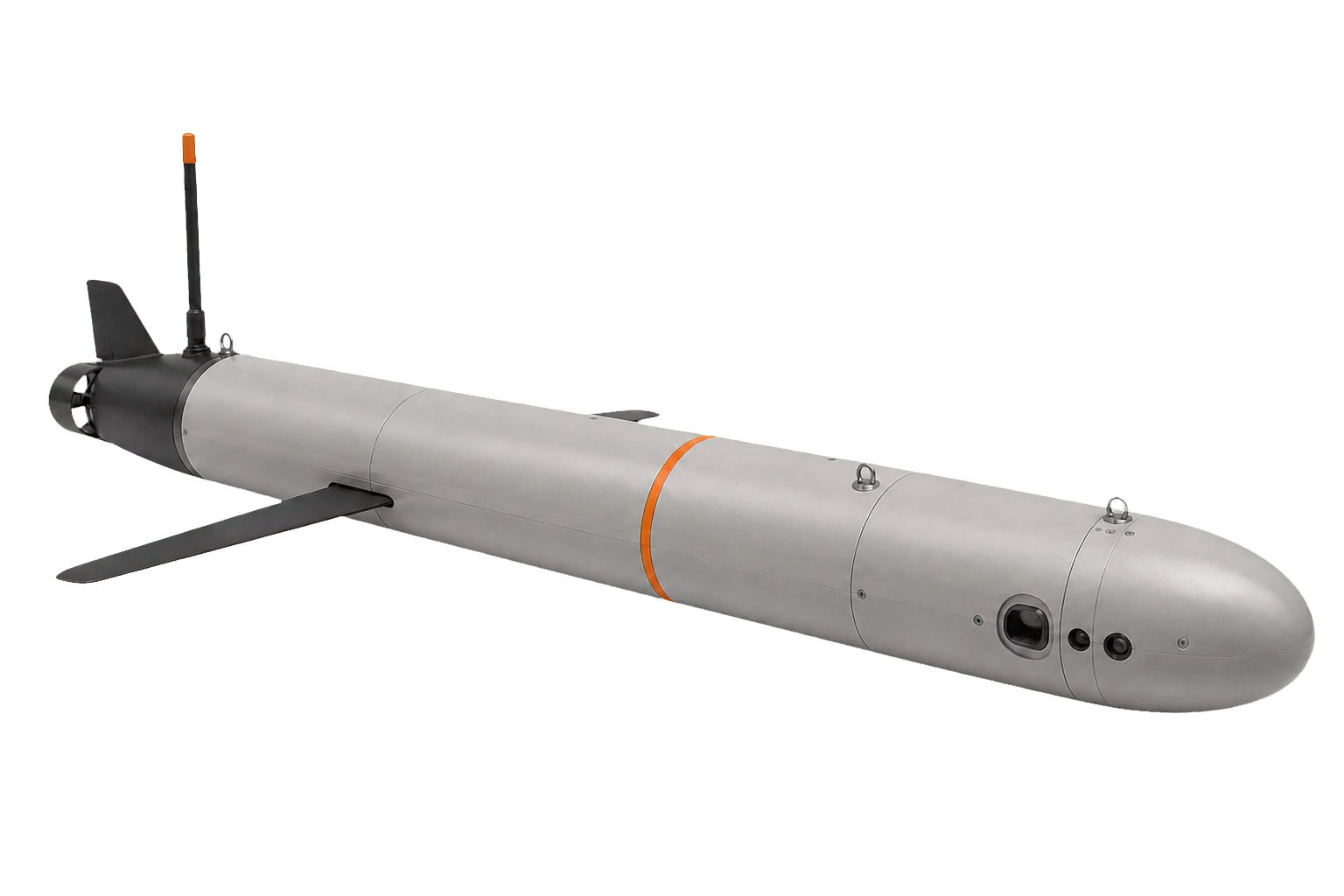
Proposed DriftWing profiling glider with a cylindrical pressure hull, fixed wings, a small tail, sensor ports, and an aft communications mast
Proposed DriftWing configuration · concept image, not a physical prototype
Stage
Concept development
Demonstrated
Mission simulation
Next proof
Instrumented prototype

One platform concept. Two operating contexts.

Civilian operators and defence organizations both need better knowledge of changing coastal water columns. DriftWing is being developed as a configurable sensing platform; application fit, payload performance, endurance, and mission economics still require validation.

01

Civilian observation

Environmental knowledge between vessel missions.

Repeated, depth-resolved observations could support environmental programs, aquaculture, ports, research, and offshore projects. DriftWing is intended to supplement vessels, moorings, satellites, and regulated sampling—not replace them.

  • Coastal observing

    Mission-specific sensors for recurring temperature, salinity, oxygen, turbidity, and related water-column profiles.

  • Environmental baselines

    Repeat observations around ports, offshore-energy sites, cables, restoration projects, and other coastal infrastructure.

  • Aquaculture and habitat

    Additional spatial and depth context for water conditions, habitat studies, and biogeochemical research.

  • Forecast and research inputs

    Periodic profiles intended to complement existing ocean models, research programs, and remote observations.

02

Defence and public safety

Ocean intelligence for planning and awareness.

Mission-specific water-column observations could support maritime planning, port and coastal awareness, exercises, and the environmental interpretation of underwater sensors. DriftWing is not presented as a fielded surveillance or defence system.

  • Rapid environmental assessment

    Water-column profiles and current estimates to inform maritime planning, exercises, and response preparation.

  • Port and route context

    Repeat, non-invasive environmental observation around approaches, critical infrastructure, and remote coastal routes.

  • Remote and Arctic observation

    A proposed lower-logistics way to collect ocean conditions between crewed visits, subject to cold-water engineering.

  • Sensor-network support

    Environmental context for existing coastal sensing networks and future mission-specific passive payloads.

Use the water column before spending energy.

Variable buoyancy drives each profile. Fixed wings convert vertical travel into glide. Forecast and observed conditions guide depth selection, while a low-duty propulsor is reserved for limited course correction.

  1. 01

    Profile

    Measure the water column during buoyancy-driven descent and climb.

  2. 02

    Select and drift

    Spend time at a depth whose current supports the mission.

  3. 03

    Correct

    Use wing-assisted glide and limited propulsion to manage position.

  4. 04

    Surface

    Transmit observations, update the plan, and begin another profile.

Modeled missions, not field performance.

A causal study replayed historical 2013 NOAA model analyses across 21 defined missions. Three reached the modeled arrival threshold. The result informs development; it does not validate a physical vehicle.

3 / 21
Modeled cases that reached the defined arrival threshold
26.1 days
Duration of one successful showcase mission
3.64 × 10⁻¹²
Maximum logged cross-language continuous-state difference

The simulator, historical-current workflow, and MATLAB/C/CUDA CPU-fallback consistency checks exist today. The CUDA GPU path is authored but has not yet been compiled or benchmarked. Numerical agreement verifies implementation consistency, not model accuracy.

Read the technical evidence note

Define the mission. Prove the system. Earn deployment.

Near-term work is structured around requirements and measured demonstrations with environmental operators, research partners, government agencies, or defence primes. Recurring services or system sales come only after performance is established.

  1. 01

    Scope the requirement

    Define the observation need, payload, operating area, recovery plan, security constraints, and measurable acceptance criteria.

    In progress
  2. 02

    Build and characterize

    Measure buoyancy actuation, energy per cycle, pressure integrity, sensing, communications, control, and failure behaviour.

    Next gate
  3. 03

    Validate in controlled water

    Establish stability, repeatability, navigation authority, payload data quality, telemetry, and recovery procedures.

    Planned
  4. 04

    Conduct a partner demonstration

    Progress to a field mission with an operating partner, safety review, clear responsibilities, and agreed evidence thresholds.

    Future gate

Built in Ontario. Seeking mission partners.

OceanStride is an early-stage project led by Ben Malvern. Work to date includes mission simulation, forecast-data integration, routing logic, and native-code implementation.

The next stage requires marine engineering review, civilian and defence user conversations, payload partners, and an appropriate controlled-water test site.

Speak with Ben